Photography of Wildlife & Natural Areas of Newfoundland, Gros Morne National Park.
MAIN
GALLERIES
ARTICLES
PRODUCTS
TRAVEL
WILD WEB
E-MAIL


Click map locations
for more info.
St. Pauls Inlet
Western Brook
Pond
Bonne
Bay
Tablelands


Gros Morne National Park

Gros Morne Mountain

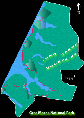
Gros Morne is a very diverse landscape encompassing a large portion of the islands west coast. It straddles three eco-regions, the Western Forest, Northern Peninsula Forest and Long Range Barrens. Mountainous terrain gives way to a flat coastal delta that was once the sea bottom. Deep fjords cut into the mountain plateau have since been landlocked to become fresh water ponds. The mountainsides are still heavily forested with primarily Balsam Fir. These areas are home to the worlds greatest concentration of Moose. Caribou live on the barren plateaus and sometimes migrate to the lowlands. The highway follows the coast through traditional outports which continue normal activities within enclaves that are outside the parks jurisdiction. Although some of the smaller settlements were removed when the park first came into existance the remaining population has benefited from a booming tourism industry while maintaining most of their traditional rights. Traffic throughout he area is high from early June until late Sept. but the roadstops and planned trails keep most travellers away from the parks most remote areas thereby allowing them to maintain their value for hardcore wilderness fans.

Back to Map

  St. Pauls Inlet

St. Pauls Inlet moose predawn light salt marsh

A saltwater lake with a narrow opening to the ocean has very shallow sections at low tide. Home to waterfowl and shorebirds, one of the few places where harbour seals can be found during summer.


Back to Map

  Western Brook

Western Brook Gorge Western Brook Moose Sand Dunes


Back to Map

  Bonne Bay

Bonne Bay Bonne Bay Deer Arm Bonne Bay Lobster Cove Lighthouse


Back to Map

  Tablelands

Tablelands Tablelands Trout River Pond Trout River Pond Star Trails

A collision of tectonic plates millions of years ago led to the upheavel of a portion of the earths mantle forming the highland plateaus of western Nfld. Iron bearing peridotite rock oxidizes to give the characteristic rusty brown color of the tablelands. A coating of sediments protected the rock from weathering until the glaciers of the last "ice age" left their mark on the land. The resulting barren rock has many easily recognizable features of glaciation, almost no vegetation and few animals.